
Mid Northeast Neighborhood Bike Network
 Mid Northeast Neighborhood Bike Network
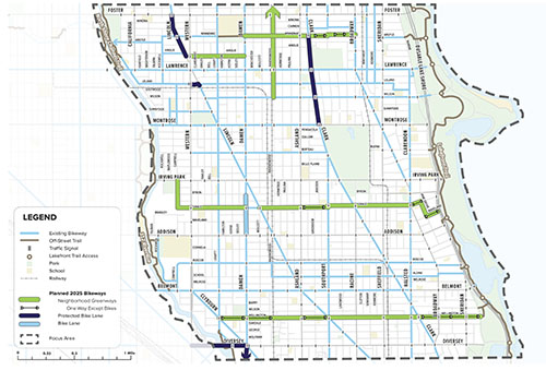
The Mid Northeast Neighborhood Bikeways Network project will fill gaps in the existing bicycle network, connecting neighbors to the North Shore Channel Trail and the Lakefront between Foster and Diversey Avenues.
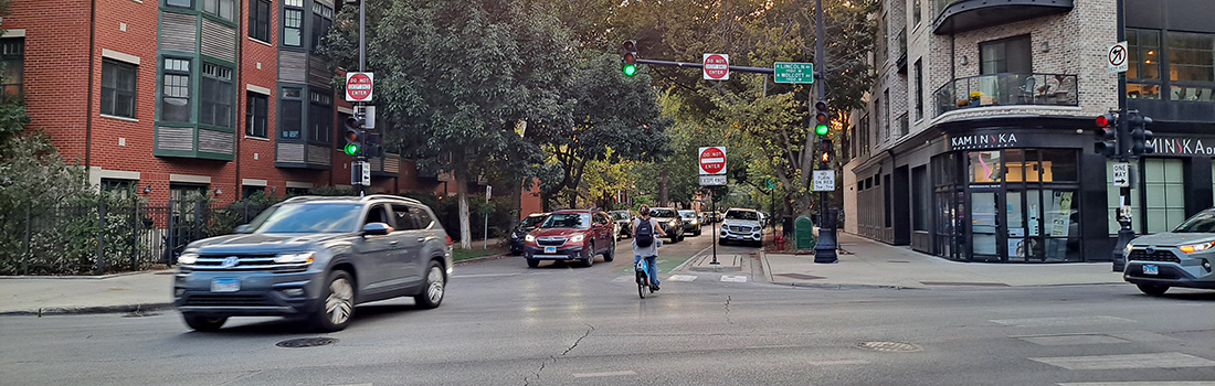
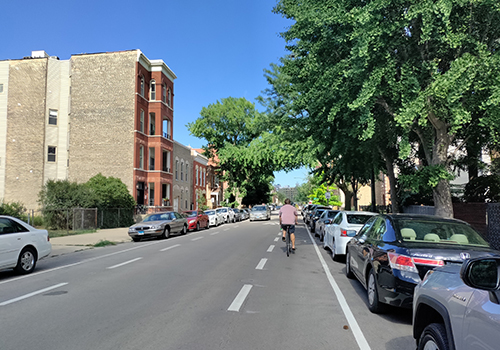
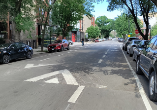
In 2025, three planned neighborhood greenways will focus on east-west connections and provide alternatives to busier commercial streets. These quieter, shadier routes, will serve as lower stress options for families and older adults to enjoy biking and explore their communities.
Planned 2025 Neighborhood Greenways:
- Select low traffic corridors with existing signals at commercial streets, long stretches without dead ends, and good connections to local schools, parks, and shops
- Boost comfort and safety through traffic calming elements that might include: speed humps, bump outs, enhanced signage, and bold pavement markings
- Create longer corridor connections for people biking by adding contra-flow bike lanes to streets that are one-way
- Maximize connections to existing and recently upgraded north-south bikeways including the neighborhood greenway on Leavitt and protected bike lanes on Clark Street.
In 2025, CDOT will begin installing a Quick-Build Network of projects. Then in the following years, we will shift focus to longer-term projects.
Advisory bike lanes are found on narrow two-way streets where drivers must slow and move to the right to pass one another. Drivers must check for people biking on the right, slow and let them pass before moving into the dashed lane. After the cars pass each other, they move back into the center lane. Watch this video to learn more.
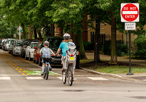
Contraflow bike lanes are designed to allow people on bike to travel against the flow of motor vehicle traffic on one-way streets. Signs and signals alert drivers to contraflow bike traffic at intersections. This practice creates more direct, low stress connections in neighborhoods.
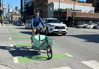
Dashed markings and bike boxes provide clear guides for people biking through intersections, and queueing at red lights. These designs position cyclists so they are more-visible to drivers, and better-organize intersections.
Traffic calming infrastructure promotes safer speeds, improves crossing distance for people walking, and better organizes traffic. Speed humps and paint-and-post curb bump-outs may be installed at key locations to create a lower-stress corridor for people biking and walking.
The 9 sq mi study area touches the Community Areas of North Center, Lakeview, Uptown, Lincoln Square and Edgewater.
-
Community Engagement - Spring 2025
- Virtual Meeting
- Monday, July 28, 2025 at 6:00 - 7:00 PM
- Meeting Materials:
- Advocate Illinois Masonic Hospital Auditorium
- July 9, 2025 at 6:00 - 7:00 PM
- Meeting Materials: