South Chicago Land Use Framework Plan
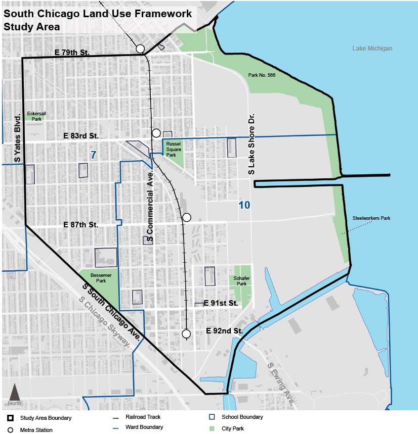
The South Chicago Land Use Framework study area is located in a portion of the South Chicago community area, covering the 7th and 10th wards.
It is bounded by 79th Street to the north, Lake Michigan to the east, the Calumet River and South Chicago Avenue to the south, and S. Yates Blvd. to the west.
The plan is intended to complement recent and pending investments in the South Chicago community area, integrating past and current planning efforts, as well as to guide future developments.

Get Involved
Questions, comments, or concerns? Please email us at dpd@cityofchicago.org.
Sign Up
Sign up for email alerts about the South Chicago Land Use Framework.